Area
The Area field is used to display one or more Polygons on a map.
field :center_area, as: :area
WARNING
You need to add the mapkick-rb (not mapkick) gem to your Gemfile and have the MAPBOX_ACCESS_TOKEN environment variable with a valid Mapbox key.
Description
By default, the area field is attached to a database column of type :json that has the Polygon- or Multi-Polygon coordinates stored in a nested Array as specified by the GeoJSON format. On the Show view you'll get in interactive map and on the edit you'll get one field where you can edit the coordinates.
For Polygons:
[[[10.0,11.2], [10.5, 11.9],[10.8, 12.0], [10.0,11.2]]]Or Multi-Polygons:
[[[[102.0, 2.0], [103.0, 2.0], [103.0, 3.0], [102.0, 3.0], [102.0, 2.0]]], [[[100.0, 0.0], [101.0, 0.0], [101.0, 1.0], [100.0, 1.0], [100.0, 0.0]], [[100.2, 0.2], [100.8, 0.2], [100.8, 0.8], [100.2, 0.8], [100.2, 0.2]]]]Options
-> geometry
-> mapkick_options
For example:
mapkick_options: { style: 'mapbox://styles/mapbox/satellite-v9', controls: true },Default
{}
Possible values
Accepts the options as specified in the Mapkick-gem.
-> datapoint_options
Fore example:
datapoint_options: { label: 'Paris City Center',
                    tooltip: 'Bonjour mes amis!',
                    color: '#009099' }
Default
{}
Possible values
Besides the general options related to the map, the area-field also accepts datapoint-options.
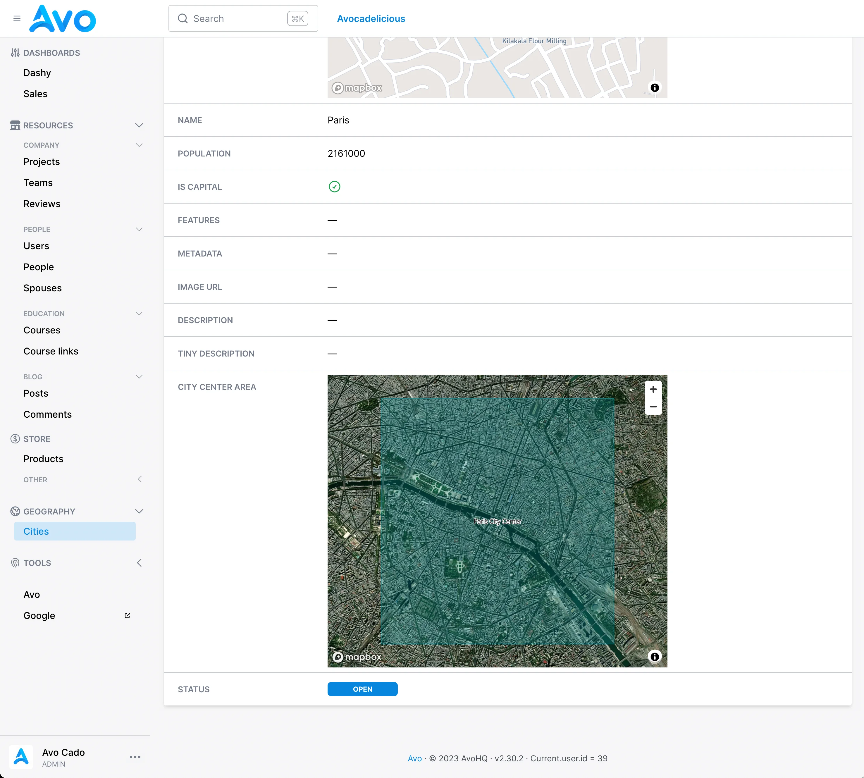
Options combined
field :center_area,
  as: :area,
  geometry: :polygon,
  mapkick_options: {
    style: 'mapbox://styles/mapbox/satellite-v9',
    controls: true
  },
  datapoint_options: {
    label: 'Paris City Center',
    tooltip: 'Bonjour mes amis!',
    color: '#009099'
  }
This will render a map like this: